
Bainbridge Island, Washington
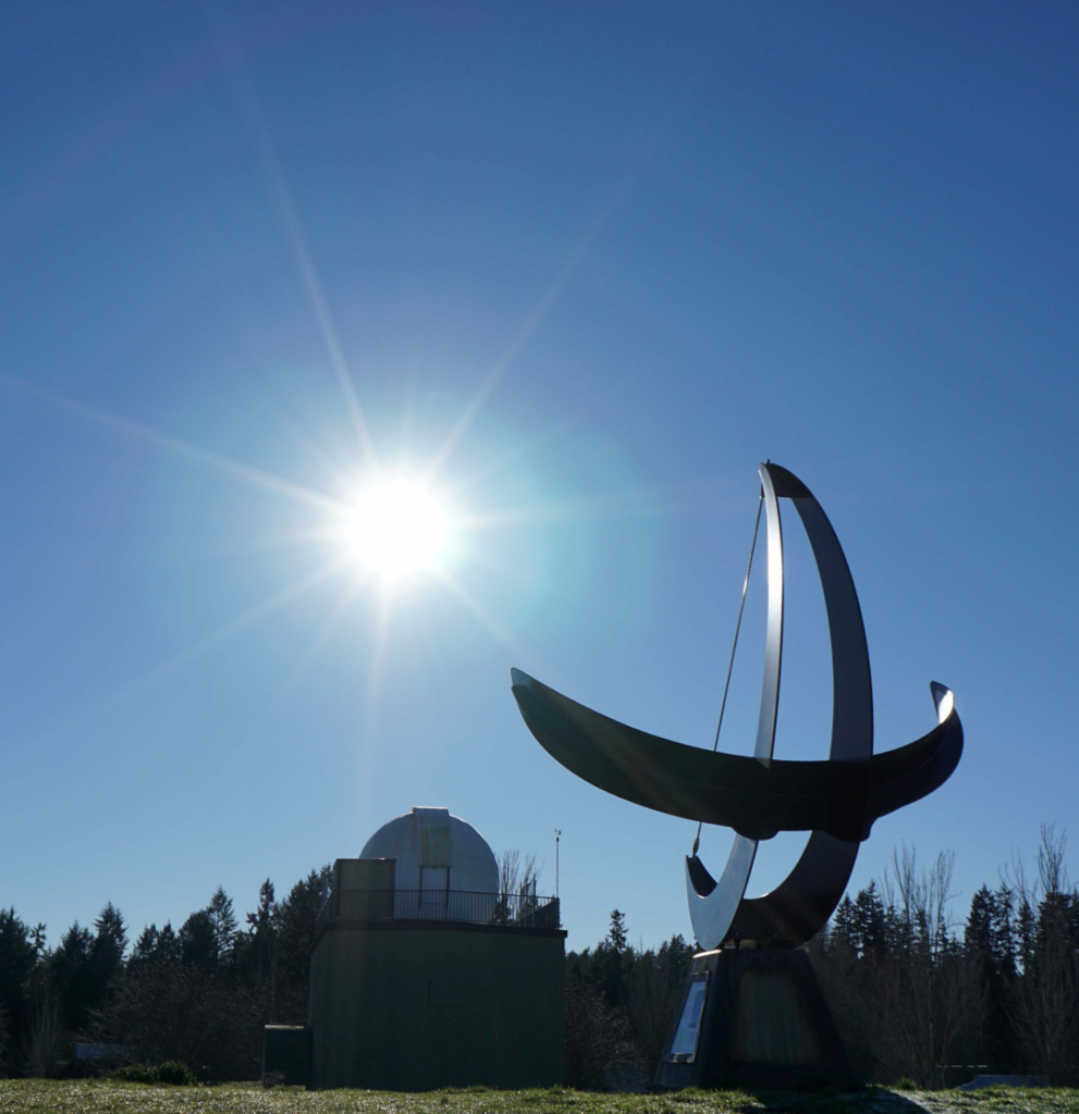
Welcome to the Battle Point Sundial! This is an Equatorial Bowstring Sundial: “equatorial” because the number arc is parallel to the Earth’s equator, and “bowstring” because the gnomon wire is stretched between the tips of a supporting bow (“gnomon” is a Greek word for “pointer”).
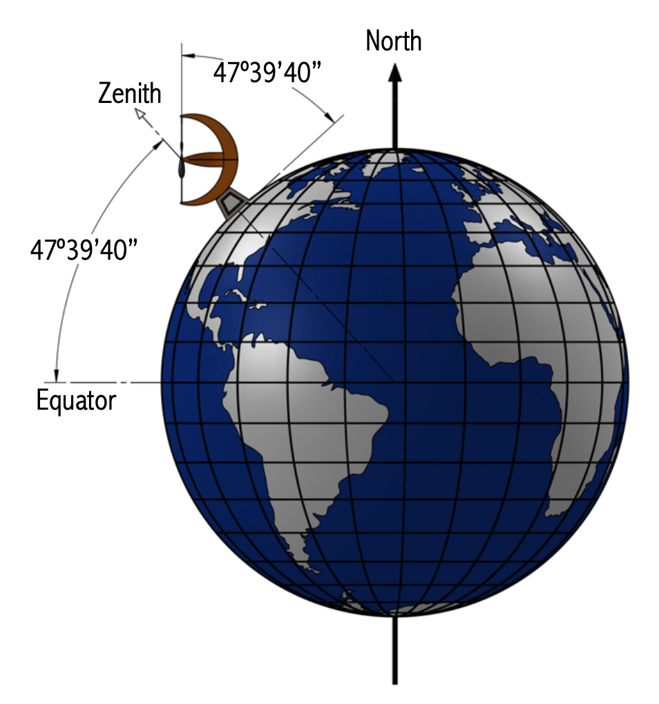
Latitude N 47º39’40” • Longitude W 122º34’38”
How Does it Work?
The Sundial faces due south and is oriented so that the gnomon is parallel to Earth’s axis and points to the north celestial pole, very near (but not exactly) to Polaris, the North Star.
As Earth turns, the Sun rises in the east, moves across the sky, and sets in the west. This causes the gnomon’s shadow to move from left to right (west to east) across the sundial’s hour scale. The shadow falls on numbers indicating the time of day. When the Sun is due south, it is “on the meridian” and the local solar time is noon.
Why Isn’t the Sundial Accurate?
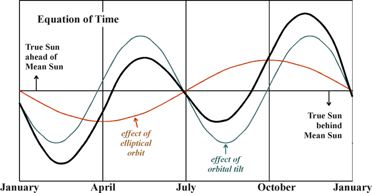
At different times of the year the Sundial will be fast or slow when compared to a clock running at a constant rate (the “true sun” is ahead or behind the “mean sun”). This discrepancy varies during the year and is caused by the interplay between two factors: the tilt of Earth’s axis relative to its orbital plane, and the eccentricity of Earth’s elliptical orbit around the Sun. This annual variation is described by the Equation of Time.
The Analemma
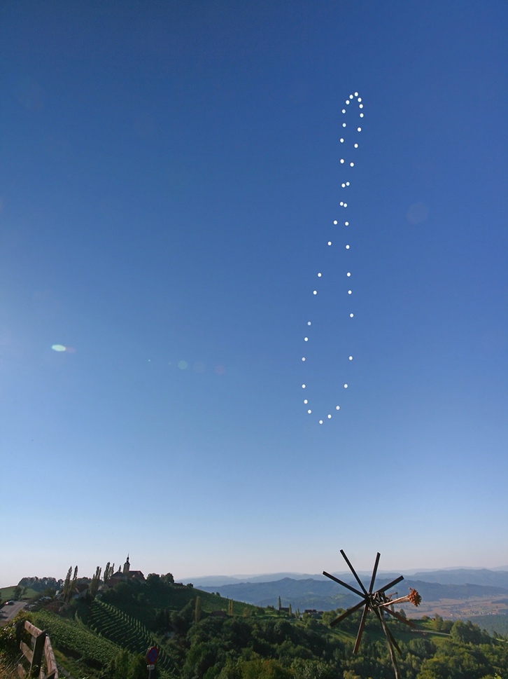
Photographs of the sun, taken at the same time each day over a year, trace a lopsided figure-8 or bowling pin shape called the Analemma. The sun’s position in the image demonstrates how fast or slow the sun was on that day of the year.
Eventually, the Battle Point Sundial will be fitted with an Analemmic Corrector mounted on the gnomon to account for this effect. Depending on the month of the year, the correct time will be read at one of the two shadow edges. Looking at the sundial you will see the Western edge of the shadow reads an earlier time than the Eastern edge. When the shadow is fast, you’ll read the Western edge. Read the Eastern Edge when the Equation of Time indicates the shadow will be slow.
Local Time Difference
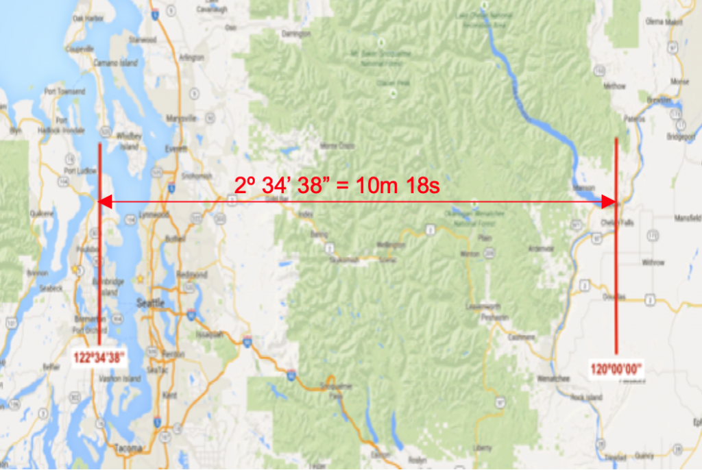
Another source of variation between the Sundial and a clock is the difference in longitude between Bainbridge Island and the central meridian of the Pacific Time Zone. The Battle Point Sundial is 2º34’38” farther west than the central meridian located near Chelan. It takes the sun an additional 10 minutes and 18 seconds to reach the meridian at the Sundial. An additional correction must be made to account for this local time difference. This correction is achieved in the Sundial’s design by shifting the hour scale east by 10m 18s. This is why the mark for noon does not fall precisely on the Sundial’s centerline.